While pursuing my master’s at USC Iovine & Young Academy, I collaborated on a project aimed at improving pedestrian experiences in urban environments. Our team developed Google Walks—a concept designed to integrate with Google Maps and address critical sidewalk-level challenges like accessibility, hazards, traffic, and overall safety. By combining real-time surveillance data, user-reported insights, and smart city infrastructure, our goal was to create safer, more informed walking routes tailored to individual needs. The project not only tackled a pressing urban issue but also demonstrated how thoughtful design and technology can make cities more walkable and inclusive.
Challenge: What is the future of pedestrian safety?
Timeline: 5 days
Role: Producer and Product Strategist
Software: Figma, Figjam, Adobe Illustrator, Adobe Premiere Pro
Software and Design Walk Through
Painpoints
-
Women often feel unsafe in unfamiliar areas, limiting confidence and mobility.
-
Current navigation apps overlook personal safety and accessibility concerns.
-
Safety-focused tools can overwhelm users with anxiety-inducing info.
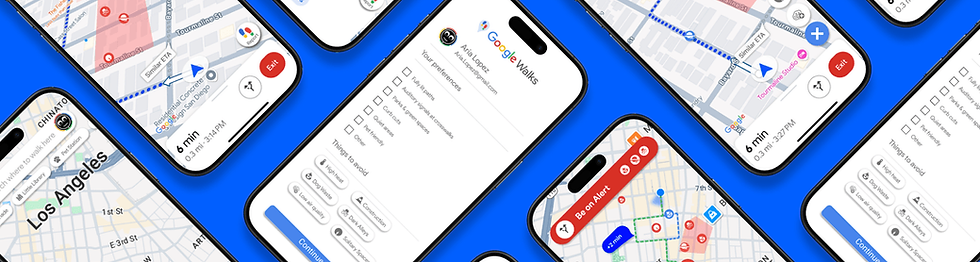
Life with Google Walks
-
Google Walks offers preference-based routing (well-lit, busy, accessible paths, hazard prevention).
-
Dynamic routing adapts to real-time data and user feedback.
-
Empowers users with safer, more informed walking routes within Google Maps.
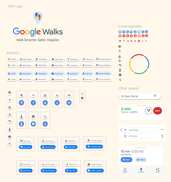
Design System